Air Quality Hot Spot Analysis - Summer 2024
Since the release of the Draft EIS, we have been working to incorporate comments from the public and agency partners to develop a Final EIS (FEIS). In response to feedback from the public and comments from agency partners, the team conducted additional air quality analysis. This analysis was focused on the area between 600 South and 600 North in SLC and the area around the I-215 interchange in North Salt Lake.
The analysis confirmed that the preferred alternative meets all conformity requirements. The technical report for the hot-spot analysis was available for public review for 30 days, ending Sept 16. Find the memo linked at right.
Draft Environmental Impact Statement - Fall 2023
The Draft EIS contains the information about the purpose and need for a project in the study area, technical analysis of various alternatives, description of the preferred alternative, potential impacts and mitigations associated with the preferred alternative, and a record of public engagement conducted and feedback received during the process. We invited the public to review these materials and provide feedback on the Draft EIS during the comment period from Sept. 29 to Nov. 13, 2023.
Navigating the Report
The Executive Summary and DEIS Overview PDFs below contain a brief background about the study purpose, processes and contents. The following chapters and maps provide more detailed information.
Cover Sheet and Contents
Chapter 1 – Purpose and Need
Chapter 1 – Purpose and Need – English (PDF)
Chapter 1 – Purpose and Need – Spanish (PDF)
Chapter 2 – Alternatives
Chapter 2 – Alternatives – English (PDF)
Chapter 2 – Alternatives – Spanish (PDF)
Chapter 3 – Affected Environment, Impacts, and Mitigation
Chapter 3 (part one)
Includes Land Use, Social Environment, Right-of-way and Relocations, Environmental Justice Populations, Economic Conditions, Transportation and Mobility, Joint Development, Air Quality, Noise, Historic and Archaeological Resources, and Water Quality and Water Resources impacts.
Chapter 3 – part one – English (PDF)
Chapter 3 – part one – Spanish (PDF)
Chapter 3 ( part two)
Includes Ecosystem Resources, Floodplains, Hazardous Materials and Hazardous Waste Sites, Visual Resources, Energy, and Construction Impacts, as well as the Indirect and Cumulative Effects, Short-term Uses versus Long-term Productivity, Irreversible and Irretrievable Commitment of Resources, Permits, Reviews, Clearances and Approvals, Mitigation, the Mitigation Summary and References.
Chapter 3 – part two – English (PDF)
Chapter 3 – part two – Spanish (PDF)
Chapter 4 – Section 4(f) Analysis
Chapter 4 – Section 4(f) Analysis – English (PDF)
Chapter 4 – Section 4(f) Analysis – Spanish (PDF)
Chapter 5 – Section 6(f)
Chapter 5 – Section 6(f) – English (PDF)
Chapter 5 – Section 6(f) – Spanish (PDF)
Chapter 6 – Coordination
Chapter 6 – Coordination – English (PDF)
Chapter 6 – Coordination – Spanish (PDF)
Chapter 7 – Preparers
Chapter 7 – Preparers – English (PDF)
Chapter 7 – Preparers – Spanish (PDF)
Chapter 8 – Distribution
Chapter 8 – Distribution – English (PDF)
Chapter 8 – Distribution – Spanish (PDF)
Chapter 9 – Responses
Chapter 10 – Index
Appendices
Appendix 1A: Purpose and Need Chapter Supplemental Information
Appendix 2A: Alternatives Screening Report
Appendix 2B: Action Alt Design Figures
Appendix 3A: Property Impact Tables
Appendix 3B: Property Impact Figures
Appendix 3C: Environmental Justice Data Tables
Appendix 3D: Alternatives Operations Analysis Memo
Appendix 3E: Project of Air Quality Concern Evaluation
Appendix 3F: Noise Technical Report
Appendix 3G: Architectural Impacts
Appendix 3H: Cultural Resources Maps
Appendix 3I: Cultural Resources Correspondence
Appendix 3J: Water Quality Technical Report
Appendix 3K: Aquatic Resources Impacts
Appendix 3L: Biological Resources Evaluation Report
Appendix 3M: Aquatic Resources Delineation Report
Appendix 4A: Figures for Section 4(f) Public Parks and Recreation Areas
Design Resources
Property Impact Map
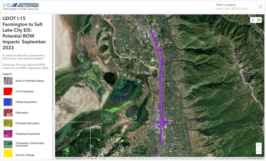
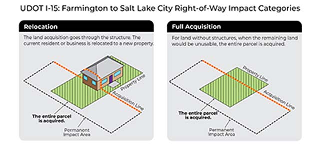
This map outlines the impacts to property as defined in the DEIS Report in Fall 2023. Zoom into any areas to see more detail.
Draft Environmental Impact Statement Release - Fall 2023
Virtual Public Open House - Oct. 16, 2023
The study team recorded the presentation and the questions and answers discussed by the study team during the October 16 Virtual Public Open House.
Para ver el video con subtítulos en español, haga clic en configuración ⚙️ y luego en “Subtitles/cc” y seleccione “Spanish” de la lista.
Time stamps to topics within the video:
- Introduction
- Study overview 2:43
- Why are we studying I-15? 3:07
- What solutions were considered? 5:06
- How were solutions considered? 7:45
- What else is being considered? 8:44
- Preferred Alternative – Mainline I-15 10:46
- Preferred Alternative – Farmington 13:05
- Preferred Alternative – Centerville 13:52
- Preferred Alternative – Bountiful/West Bountiful 14:15
- Preferred Alternative – North Salt Lake/Woods Cross 15:33
- Preferred Alternative – Salt Lake City 16:33
- What are the property impacts? 18:22
- What are the noise impacts? 21:47
- What are the air quality impacts? 22:43
- How do I give input? 25:16
- Next Steps 26:42
- Q&A 27:49
In-person Public Open House and Hearing
Oct. 17, 2023
Utah State Fairpark, Bonneville Building
155 North 1000 West, Salt Lake City, UT 84116
5:00 pm – 7:00 pm
In-person Public Open House and Hearing
Oct. 18, 2023
South Davis Recreation Center
550 North 200 West, Bountiful, UT 84010
5:00 pm – 7:00 pm
Available at each public hearing:
- Kid’s activities
- Food
- Translation services
Free Transportation to in-person events:
i15eis.udot.utah.gov/Transportation
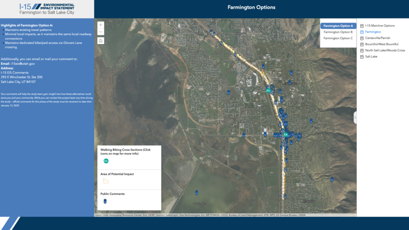
DEIS Comment Map
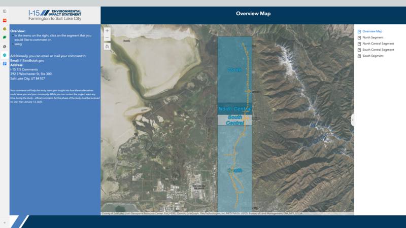
For review only; no longer accepting comments at this time.
Alternatives Development and Screening Report - Spring 2023
The Alternatives Phase is an essential part of the NEPA process. With the public’s input from the Scoping and Purpose and Need Phases and based on technical analysis and engineering, the study team identified potential improvements – known as alternatives – within the corridor. The alternatives were made available for public comment November 10, 2022 – January 13, 2023. Learn about the alternatives below.
Virtual Public Meeting Recording
Presentation Overview (5:05)
EIS Process & Alts Phase Overview (6:01)
- Helpful Terms (11:11)
Alternatives Review (13:13)
- Mainline I-15 (13:36)
- Farmington (18:22)
- Centerville (20:14)
- Bountiful/West Bountiful (22:30)
- North Salt Lake/Woods Cross (23:52)
- Salt Lake City (25:26)
Public Comment Period & Next Steps (27:17)
Questions & Answers (31:35)
Website Overview (1:15:55)
Additional Questions & Answers (1:19:27)
Alternatives Phase Public Meetings
November 14
Virtual Meeting 5:00-7:00 pm
November 15
Rose Park Elementary
1105 W 1000 N, Salt Lake City
5:00-7:00 pm
November 16
South Davis Recreation Center
550 N 200 W, Bountiful
5:00-7:00 pm
Available at the Open Houses:
- Kid’s activities
- Food
- Translation services
- Transportation assistance
Draft Alternatives Document for Review:
Alternatives Phase - Winter 2022-2023
The Alternatives Phase is an essential part of the NEPA process. With the public’s input from the Scoping and Purpose and Need Phases and based on technical analysis and engineering, the study team identified potential improvements – known as alternatives – within the corridor. The alternatives were made available for public comment November 10, 2022 – January 13, 2023. Learn about the alternatives below.
Virtual Public Meeting Recording
Presentation Overview (5:05)
EIS Process & Alts Phase Overview (6:01)
- Helpful Terms (11:11)
Alternatives Review (13:13)
- Mainline I-15 (13:36)
- Farmington (18:22)
- Centerville (20:14)
- Bountiful/West Bountiful (22:30)
- North Salt Lake/Woods Cross (23:52)
- Salt Lake City (25:26)
Public Comment Period & Next Steps (27:17)
Questions & Answers (31:35)
Website Overview (1:15:55)
Additional Questions & Answers (1:19:27)
Alternatives Phase Public Meetings
November 14
Virtual Meeting 5:00-7:00 pm
November 15
Rose Park Elementary
1105 W 1000 N, Salt Lake City
5:00-7:00 pm
November 16
South Davis Recreation Center
550 N 200 W, Bountiful
5:00-7:00 pm
Available at the Open Houses:
- Kid’s activities
- Food
- Translation services
- Transportation assistance
Draft Alternatives Document for Review:
Scoping and Purpose and Need Phase - Spring 2022
The Scoping, Purpose and Need phases are important parts of the NEPA process where we analyze the needs in the corridor. Using technical analysis and engagement with the public we ultimately arrive at a formal statement of needs and purpose for the study. As part of this phase, a public comment period was held from April 11 – May 13, 2022. Learn more below.
Final Scoping Report
Draft Documents - Updated September 2022
GIS Comment Map
For review only, no longer accepting comments at this time.

